 IDG TETIS
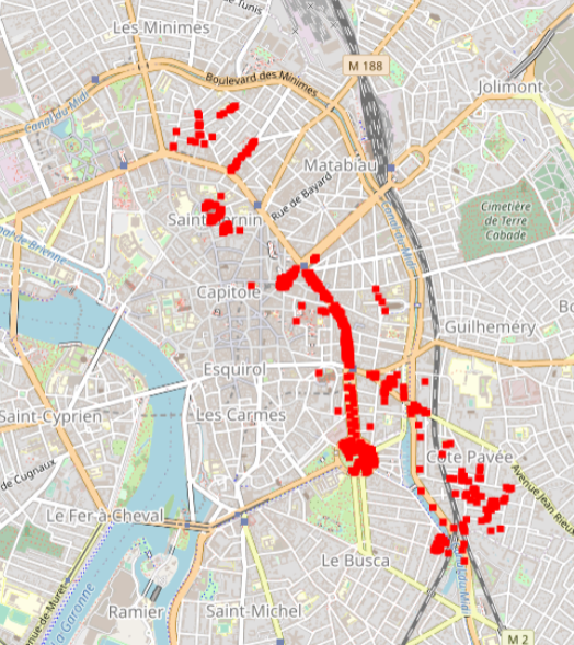
Toulouse 2015 Supervised SVN classification results for 600 urban trees according to a 3 level nomenclature
Hyperspectral data were obtained during an acquisition campaign led on Toulouse (France) urban area on July 2015 using Hyspex instrument which provides 408 spectral bands spread over 0.4 – 2.5 μ. Flight altitude lead to 2 m spatial resolution images. Supervised SVN classification results for 600 urban trees according to a 3 level nomenclature: leaf type (5 classes), family (12 and 19 classes) and species (14 and 27 classes). The number of classes differ for the two latter as they depend on the minimum number of individuals considered (4 and 10 individuals per class respectively). Trees positions have been acquired using differential GPS and are given with centimetric to decimetric precision. A randomly selected subset of these trees has been used to train machine SVM and Random Forest classification algorithms. Those algorithms were applied to hyperspectral images using a number of classes for family (12 and 19 classes) and species (14 and 27 classes) levels defined according to the minimum number of individuals considered during training/validation process (4 and 10 individuals per class, respectively). Global classification precision for several training subsets is given by Brabant et al, 2019 (https://www.mdpi.com/470202) in terms of averaged overall accuracy (AOA) and averaged kappa index of agreement (AKIA).
|
|
Citation proposal
. Toulouse 2015 Supervised SVN classification results for 600 urban trees according to a 3 level nomenclature. https://idg-tetis.teledetection.fr/geonetwork/srv/api/records/e324c038-08f3-4a11-aca2-7abbeda014e7 |
INSPIRE
Identification
- File identifier
- e324c038-08f3-4a11-aca2-7abbeda014e7 XML
- Hierarchy level
- Dataset
Online resource
- Protocol
- file for download
- Protocol
- OGC:WMS
Resource identifier
- code
- e324c038-08f3-4a11-aca2-7abbeda014e7
- Metadata language
- English
- Spatial representation type
- Vector
Encoding
- Format
- ESRI Shapefile
- Version
- 1.0
Projection
- code
- 4326
Classification of data and services
- Topic category
-
- Geoscientific information
- Environment
Classification of data and services
Coupled resource
Coupled resource
Classification of data and services
Coupled resource
Coupled resource
Keywords
- General ( Theme )
-
- remote sensing
- VHRS imagery
- HYPERSPECTRAL imagery
- urban studies
- GEMET - INSPIRE themes, version 1.0 ( Theme )
- GEMET - Concepts ( Theme )
- GCMD Keywords viewer ( Theme )
- TETIS Thesaurus, version 1.0 21112019 ( Theme )
Other keywords
Geographic coverage
N
S
E
W
))
Temporal reference
Temporal extent
- Begin
- 2015-07-01T00:00:00Z
- End
- 2015-07-31T00:00:00Z
Temporal extent
- Date ( Revision )
- 2022-05-17T19:09:06
Quality and validity
- Lineage
- Hyperspectral data were obtained during an acquisition campaign led on Toulouse (France) urban area on July 2015 using Hyspex instrument which provides 408 spectral bands spread over 0.4 – 2.5 μ. Flight altitude lead to 2 m spatial resolution images. Supervised SVN classification results for 600 urban trees according to a 3 level nomenclature: leaf type (5 classes), family (12 and 19 classes) and species (14 and 27 classes). The number of classes differ for the two latter as they depend on the minimum number of individuals considered (4 and 10 individuals per class respectively). Trees positions have been acquired using differential GPS and are given with centimetric to decimetric precision. A randomly selected subset of these trees has been used to train machine SVM and Random Forest classification algorithms. Those algorithms were applied to hyperspectral images using a number of classes for family (12 and 19 classes) and species (14 and 27 classes) levels defined according to the minimum number of individuals considered during training/validation process (4 and 10 individuals per class, respectively). Global classification precision for several training subsets is given by Brabant et al, 2019 (https://www.mdpi.com/470202) in terms of averaged overall accuracy (AOA) and averaged kappa index of agreement (AKIA).
Conformity
Conformity
Conformity
Conformity
Conformity
Conformity
- Explanation
- some explanation about the conformance
- Explanation
- See the referenced specification
- Explanation
- See the referenced specification
Restrictions on access and use
Restrictions on access and use
Responsible organization (s)
Contact for the resource
- Organisation name
- UMR TETIS - CNRS
- Christiane.Weber@cnrs.fr
Responsible organization (s)
Contact for the resource
- Organisation name
- UMR TETIS - CNRS
- Christiane.Weber@cnrs.fr
Metadata information
Contact for the metadata
- Organisation name
- LETG - Univ Rennes 2
- Organisation name
- UMR TETIS - CNRS
- Christiane.Weber@cnrs.fr
- Organisation name
- UMR TETIS - CNRS
- Claudia. Lavalley@cnrs.fr
- Date stamp
- 2022-05-17T19:25:04
- Metadata language
- English
- Character set
- UTF8
SDS
Conformance class 1: invocable
Access Point URL
Endpoint URL
Technical specification
Conformance class 2: interoperable
Coordinate reference system
Quality of Service
Access constraints
Limitation
Use constraints
Limitation
Responsible custodian
Contact for the resource
Conformance class 3: harmonized
Overviews
SVN Toulouse urban Trees classification
Provided by

Views
e324c038-08f3-4a11-aca2-7abbeda014e7
Access to the portal
Read here the full details and access to the data.
Associated resources
Not available